Sunday, May 19, 2019

Tue., May 7, 2019. Day 29/85. Super 8 Motel, Carlisle, PA. 40.2330N77.1089W. 16.6 miles. 6 hrs, 30 mins. 2.6 mph. 1,131.3 / 1060.7 to go.

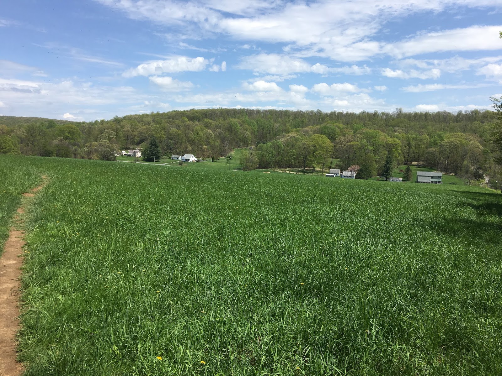
Last night I saw that the trail went right by some hotels at 17 miles. I figured I could stay there and have someone deliver my pack so I could slack pack. So, I did it. It was probably the easiest hike for a full day that I have done on the entire trail. The first 1/3 had a couple mountains that were no greater than a 500 foot climb. Then the rest was gradual farm land in the Cumberland Valley. I read that it is a 13 mile section that is the longest, lowest, and flattest section on the entire trail. I agree. They were almost level. With no backpack I made great time. 

During the last climb in the mountain section I came upon a lady who had twisted her ankle and leg. I carried her pack to the top of the hill. My Boy Scout good deed for the day. :-). The rest was a gradual downhill she said. She had come from that way. I offered to carry it more but she said no. That slowed me down, otherwise I would have made it to the the Motel a half an hour earlier. It was a very easy day. I hardly sweated. 

I met Shade Hunter. He served in Iraq for several years. Someone had told me about him at a shelter. He is about my age, maybe a little younger. The other night when it was raining he came to the shelter, saw it was full and then walked off. None of us at the shelter realized he had left. When I saw him today I told him we all felt sorry that he left. We would have made room for him. He said he didn’t feel anyone said that , or felt that. He just observed it. He ended up camping a couple miles down the trail in the rain. The next morning I saw where he had written his name in the trail. We talked about it. He seems like a great guy. He related how in Boiling Springs a couple had picked him up and had him stay with them. Nice people, true trail angels.

Pictures:

1. Cumberland Valley ahead. Level for 13 miles. Sweet.
2. Boiling Springs. Plaque telling about the town of Boiling Springs. The trail goes through the town.
3. Two pictures showing a blast iron furnace in Boiling Springs.
4. Steps over a fence with a white blaze painted on a pole on the other side to mark the trail.
5. A cemetery from the past.
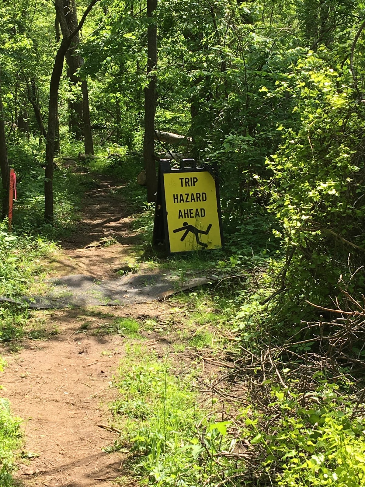
6. What?? A warning about a trip hazard on the trail. Most of the trail is a trip hazard, I do trip. My guess is that OSHA required the contractor to put it up where they are working. I laughed. Haven’t seen a warning before, and don’t expect to see one again. :-).




Mon., May 6, 2019. Day 28/84. Holly Inn in Mount Holly Springs, PA. 40.0915N77.1681W. 3.3 miles. 1 hrs, 20 mins. 2.5 mph. 1,114.7 / 1077.3 to go.

My plan worked. This last week I figured my mileage so I would be at a shelter only about 4 miles from the town I would stay in. That way I would have more time to get all of my off the trail day items done. Here Is a list in case you are interest. Laundry, blog (takes a lot of time finishing and uploading), phone calls, planning future route for food mailings, buying supplies, equipment repair and purchase, drying equipment from rain (big job), repacking, catching up on emails and texts, and a little R&R. Oh, also eating some real food and sleeping in a real bed. 

Often I would like to stop, but don’t do it because of the logistics of a town not being convenient.

The sun was out and I got everything dried in a quick time. My tent was completely wet. It took the most effort.

My backpack is getting a hole in it where the internal frame hits the bottom. When I am home I am going to have to somehow sew over a heavy material patch. I am concerned that the frame will poke out and then the pack will not stay upright. Could be a major problem.

Pictures:

1. Only one poor picture of the inside of a shelter. Note there are only 3 walls. I am taking the picture in the morning as people are getting ready to go. I am taking it from above in my bed.

I should have taken one of the Holly Inn in Mount Holly Springs, PA. It is a quaint town.


Sun., May 5, 2019. Day 27/83. James Fry Shelter. 40.0630N77.2063W. 17.1 miles. 6 hrs, 40 mins. 2.6 mph. 1,111.4 / 1,080.6 to go.

A very significant day:

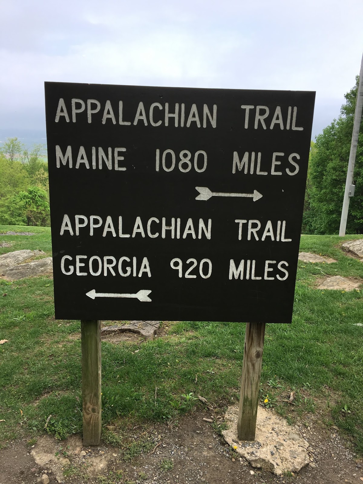
I passed the official half way point. See the picture. This is a very important accomplishment to me. It almost seems impossible to me that I have hiked 1,111.4, half the distance.

Second, I passed 300 miles since I started this year.

NOTE, NOTE:  Note that the miles to hike is less than the miles hiked. Am I excited. YES.😀😊🙃😊☺️😁ðŸĪĐðŸĪŠðŸ’Đ

It rained all day. I was soaking wet when I got to the shelter. I fortunately was able to change to dry clothes and be in a shelter. I got an upper bed bunk and didn’t have to sleep on the floor. I feel wonderful as it still pours hard outside the shelter.

Walking in the rain is terrible. You get wet. Even with a poncho you get wet. I wonder if I get wetter with a poncho, or with out one. I think I sweat more than being in the rain. At least the sweat stays warmer. My very expensive water proof boots felt damp, but I think it was my sweat, and not water getting in. The rain is suppose to stop tonight, at about 8 pm. So far, at 5:45 pm it doesn’t look like it is going to every stop. It has been a consistently moderate rain.

About noon time the trail went through Pine Grove Furnace State Park. There was a small resupplies store and cafe. There were several hikers there. They raved about the hamburger. They had a hikers burger. So I had it. It was good. It was worth the stop.

I got ahead of the group from the last shelter. Five I passed while hiking. A couple I saw at the store and left before they left. I was the fourth person at the shelter and got one of the four beds. Five others came. They slept on the floor that was meant for four people. It was raining so no one was going to tell someone else they had to set up a tent.

It was a good group in the shelter. Two older, including me, three mid age that were together, and four younger. We played the heads up game. I was the expert how to play it because I have played it with my grandchildren. I didn’t do very good on my turn. As usual we went to slept by 8 pm.

It was a wonderful morning to wake to no rain, and none in the forecast.


Pictures:


  1. Halfway point marker for the entire Appalachian Trail. Ypee!!!! Note mileage on sign. Exact.
  2. Me - Wet and hiking. At the shelter when I arrived.


Friday, May 17, 2019

Sat., May 4, 2019. Day 26/82. Birch Run Shelter. 39.9848N77.4194W. 15.7 miles. 6 hrs, 35 mins. 2.4 mph. 1,094.3 / 1,097.7 to go.

I was able to balance out the mileage. Tomorrow I will do 17.1 That is better than the 19+ that I was going to do. The day after I will be hiking only 3.3 miles from the shelter to the pickup point to go to the Mount Holly Inn. They have a food box for me, plus a night stay. It is forecasted 100% to rain tomorrow. It is 6 pm and it has already started to rain. I will probably have to pack my bag in the rain tomorrow morning. I guess that is how you have memories. Serves my right for hiking on Sunday.

I was planning on staying in a shelter tonight. I arrived, took of my backpack and talked with people there. Three men hiked in after me. Said, any room left. One of the woman there said, yes 3 places. He immediately said we will take them. In a blink of the eye I am camping outside in the rain. If they show up where I am tomorrow that isn’t going to happen. As soon as I get there I am going to grab a spot. I plan to be there early. I want to start hiking tomorrow at day break, 6:00 am.

I do not think the hikers that came in after me were trying to sneak into my spot, but it happened. It did end up raining all night long and the next morning. I did end up packing my wet tent in my back pack. The first time I took it out was when I was at the hotel. It was dripping when I took it out. Fortunately, it was sunny and I was able to dry out everything.

Pictures:
  1. Me. I was taking one of my 3 hour breaks. Every 3 hours I stop, take off my pack, and drink some of my extra water that I carry in my pack. It refreshes me. Very helpful.
  2. Three pictures of the trail. The third shows tree routes in the trail.


Fri., May 3, 2019. Day 25/81. Stealth Camping on trail. 39.8385N77.5050W. 17.7 miles. 8 hrs, 20 mins. 2.1 mph. 1,078.6 / 1,1113.4 to go.

A good day of hiking. First I passed the Mason Dixon line. In this area this is a big event, line. I do not know why. If you ever wonder if people still honor the South, the answer is a very strong yes. I will let you figure out the significance to the line. Second that same line is the Maryland and Pennsylvania border. In three days I walked through the state of Maryland, any way that part that the AT traverses. 

I also had my first trail magic. See the picture below. It was wonderful. There are many people that leave treats for hikers that come along. I had a candy bar and chips. Very good. THANK YOU TRAIL ANGELS.

There was to be a thunderstorm at 1 to 2 pm. My goal was to make it to the Tumble Run Shelter by 2 pm. I made it at 1:25 pm. People told me warning was moved back till 5 pm. I decided to hike till 4:30 and then set up camp. I had to carry my water. I carried an extra 1 gallon and 1 quart. That is about an extra 8 pounds. Right from the shelter there was a steep climb. I did okay. The big win is tomorrow. I am cutting down longer legs as I move to my hotel on the 6th.

As far as the thunderstorms it started at 7:15 pm. I had some light showers, but that was all. The interesting thing is that I can hear the thunderstorm to the south of me. It is suppose to pass through and be dry in the morning. I hope so.

There were two different groups that were hiking to the next shelter that passed me. I could have done that, and got there at about 6:30 pm. Tonight will tell if I made the right decision. It is fun and scary to hear the thunder so close. I might get lucky and it will pass to the south, but I do not expect that.

Good hike today, even though there were some tough areas. Good weather. Sunny.
I sucked in 3 bugs while breathing hard while climbing a steep hill. Spit them out, I hope. Sucking in bugs isn’t fun. I have to start breathing harder with my mouth closed. Not sure I can do that.

I got some more mosquito bites last night. So, I am itching again. The first thing I did when I arrived at camp was to spray on some Deet. Hope it helps.

I am liking my new hat. I have had several complements about it. One guy said that I knew I was always on the right trail because it has a white blaze in it. I took it off, turned it around, and said I hope I never get that loss of the trail that I have to look at my hat.

Well the thunderstorm really came. It started at 7:45 pm. I expect it to last about 45 minutes. I was wrong. Ended at 10:15 pm. My estimate wasn’t any good. My tent is doing good. I am dry and cozy typing on my iPad and reading the scriptures. There could be multiple storms, which could last most of the night. I am in a lower area and so far haven’t had any strong winds. There are trees all around me. I will report tomorrow how long the storm lasted, and if I had any problems. The last thunderstorm I was in with this tent I was on top of a mountain, in the open, and next to some radar and radio equipment. I was truly worried that time. Tonight no large concerns as long as my tent stays dry. So far so good. Good Night.ðŸ˜ī.

PS. Next morning. The storm did as it was suppose to. It passed through during the night and all was dry in the morning. All is good.

Pictures:

1. Sign in a park in the city of Pen Mar, Maryland. Located very near the Mason Dixon Line.
2. Mason Dixon marker.
3. beautiful stream. Looked like a good fly fishing stream.
4. Trail Magic left where the trail crossed a highway. Thank you trail angles.


Thur., May 2, 2019. Day 24/80. Raven Rock Shelter. 39.6733N77.5307W. 18.8 miles. 8 hrs, 45 mins. 2.1 mph. 1,061.5 / 1,130.5 to go.

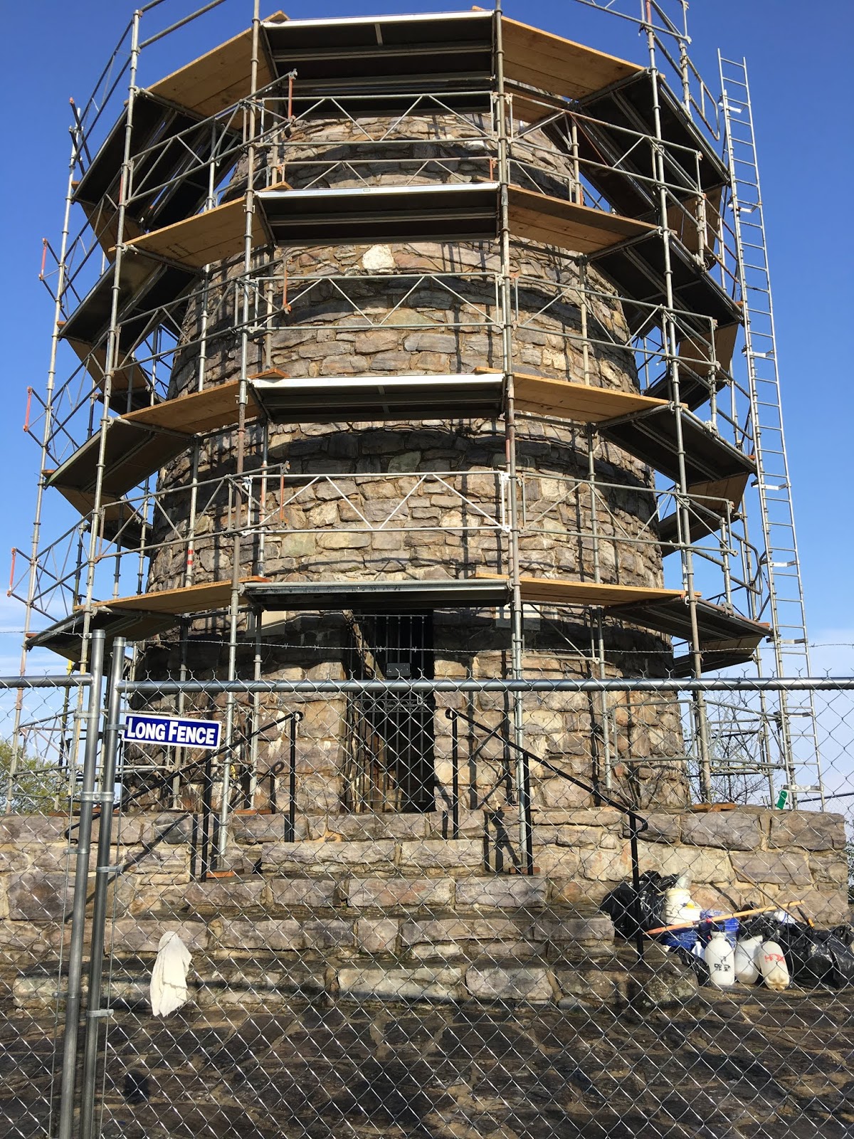
The day started good when I got to see the first Washington Monument. It was erected by the stat of Maryland. Unfortunately, it was being restored and I was unable to into it. The ranger said it had a good view.

It was a tough day, but the weather was good. I had several steep ups and downs. Also some rock ridges to cross. I think those are the worse. They slow me down and I have to be careful not to trip, or twist an ankle.

The sun was out today, but still a pleasant temperature. I dread when summer arrives and it is hot and humid. It wasn’t humid today. That is a blessing.

The shelter I stayed at didn’t have water. I had to get water at a spring that was .6 miles from the shelter. So, I carried about 10 extra pounds of water. That wasn’t to bad, except it was a very steep hill to get to the shelter. I did learn that I could carry the extra weight without a problem. My pack seems heavier to me now compared to 2016. I don’t think it is, I guess it is just the way the memory, or age works. :-).

There were 6 at the shelter when I got there. They said they do not get up that early. I decide to put up my tent. I also put up a clothes line to dry out and freshen my clothes and camping equipment. It was a wonderful afternoon. I enjoyed the breeze and cool afternoon. If all days could be like this at the shelter life would be perfect on the trail.


A young lady, Lisa, who I met on the trail camped near me. When she arrived at the camp she introduced herself with her trail name, which I do not remember. She said she was Lisa when we met, but had decided to start using her trail name by the time she reached camp.


Pictures:


1.  Mount Vernon hut at the bottom of the park. A road leads up to the Washington Monument.
2.  First Washing Monument.
3.  Description of the Washington Monument.
4.  Looking down the trail I am hiking. The steepest and roughness doesn’t show in a picture.
5.  Finally a field to walk across. It is a nice change from the past four weeks of mountain trails 


Tuesday, May 7, 2019

Wed., May 1, 2019. Day 23/79. Dahlgren Backpack Campground. 39.4812N77.6193W. 18.2 miles. 7 hrs, 50 mins. 2.3 mph. 1,042.7 / 1,149.3 to go.

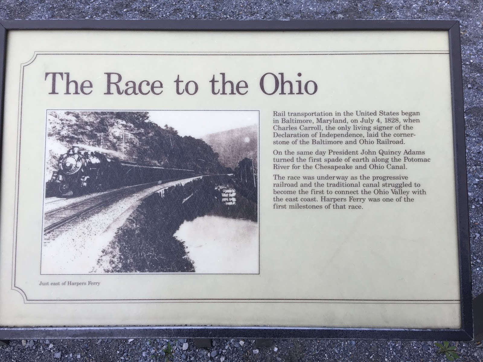
I left Harpers Ferry. Walking along the edge of the city was a hike in itself. I then crossed the railroad track that crosses the Potomac. After that for about 3 miles I followed the old C & O Canal. It was interesting to see how Mother Nature takes back what isn’t kept up. The canal channel is still there, but you would never know it was a canal. A little water, but not flowing, is in it. Trees are grown all over the banks. The road we hiked has been kept up, but there is no indication of how the mules would pull the barges. I guess it quit being used once the railroad arrived.

This is my fourth week and I am feeling in the groove. It was a joy to hike today. My body, shoes, and pack all felt good. I had one hill to climb, which I did pretty good on. I am still having to stop to often while climbing. I am getting better though.

I camped at Dahlgren Backpack Campground. Maryland State made and maintains it. It had about 8 tent sights. The best part is that it had hot water showers. I got to shower. There were two others camping there.

Drew was another camper. He is headed south and doing the Maryland section. I learned it takes only three days to hike the AT through Maryland. When he heard that I came from Harpers Ferry today, one day, he decided to do it in one day. He was going to camp another day, but realized it wasn’t that far or hard.

After showering Drew and I went and ate at the South Mountain Inn. It was a fancy restaurant that was about 1/4 mile up a road that paralleled the trail. It was very good. I had crab soup and a fish plate. I do not remember the kind of fish.

My boots started pulling apart at the ball of the left foot. See the picture. It is a little over 200 miles. No sure how that will affect the water proofing. See the picture.

I got a new hat and bandana at the ATC - Appalachian Trail Conservancy. See pictures.

Pictures:

1. Leaving Harpers Ferry, West Virginia.
2. Rail road bridge crossing Potomac. AT path. Leaving W.V. and entering Maryland.
3. C & O Canal pictures. 8 pictures.
4. White blaze on a tree and my new hat. Three pictures
5. New Bandanna.
6. Shoe separating. Two pictures.